The use of drones in the various tasks on a farm, both in the agricultural and livestock sectors, is no longer a “luxury”. It has become a necessary piece of equipment due to its versatility, making the investment worthwhile.
But its popularity is leading authorities in the rural sector to debate and regulate its use, especially when the subject refers to spraying and biological control of crops.
A technical group is being formed to develop guidelines for future actions.
The objective is to define a normative instruction prepared by the Ministry of Agriculture, Livestock and Supply that will allow, for example, aerial application of pesticides in areas where agricultural planes cannot reach.
Use of drones in crops
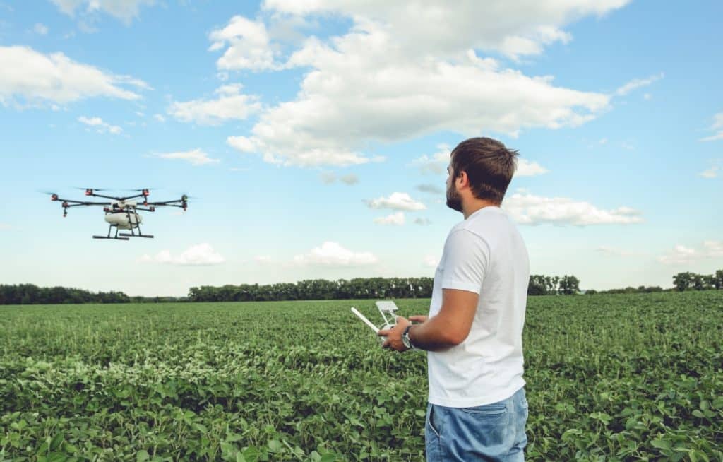
Spraying in crops is usually done using machinery on the ground, agricultural planes or even with a backpack sprayer, in the case of small properties or experimental areas.
Small unmanned aerial vehicles have some advantages over traditional tools.
Drones can fly over hard-to-reach areas, localized spraying in places with control failure, do not cause the crop to be crushed at the time of product application, and the applicator’s exposure time is shorter.

Drones can spray without damaging the crop
It is quite common in some countries in Asia, pioneer in providing this service. In China, for example, about 30 devices are used in this task. However, few countries in the world have specific rules for their operation in rural areas.
In Brazil, its use for spraying is still recent, but it has been growing in some crops, such as eucalyptus, sugarcane, rice, coffee and oranges, in the South and Southeast regions of the country. In agriculture, it was mostly used to detect pests and diseases.
In the State of São Paulo, since 2019, they are used in the green belt of the capital of São Paulo, where most of the fruits and vegetables consumed by the largest capital in the country are produced.
Drones are used to spray macrobiological products, such as natural predators and parasites, with the advantage of reducing the volume of water for this activity and also faster.
The equipment can cover an area of three hectares per hour while conventional application only reaches 0,24 hectare/hour. Not to mention the advantage of reducing the damage caused by transit between crop lines.
drone regulation
The Secretary of Agriculture of the State of São Paulo, Gustavo Junqueira, defends the implementation of specific norms, even if they are not very restrictive, as a way of improving and using technology, always seeking efficiency and safety for everyone.
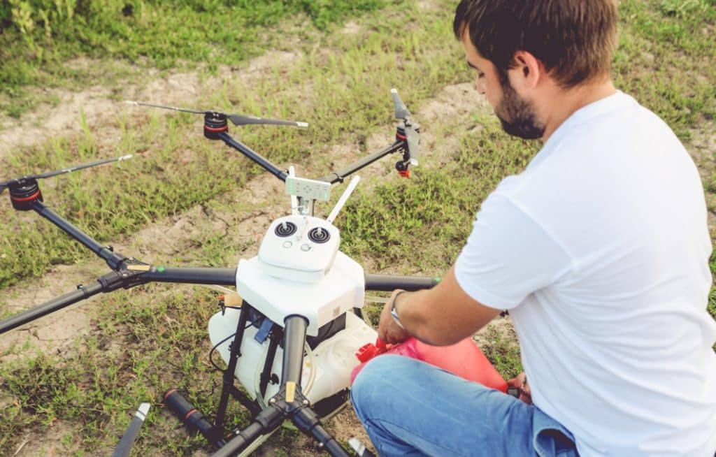
The professional who will fly the drone must be qualified to operate it safely
According to the president of the Brazilian Aerospace Industries Association (AIAB), Nei Brasil, the State of São Paulo is the leader both in technological development and in the use of spray drones in crops, passing the mark of 1 million hectares treated annually.
For the aerospace engineer Wender Santos, technical director of SkyWorks Agro, he also defends improvements in some points of the legislation so that the country can increase productivity, remain at the forefront and attract more foreign investment to the technology sector.
In addition, some adjustments still need to be made in the use of drones for spraying, such as drift, so that the technology is fully adopted by the market and also to guarantee the permanence of service providers, explained Wender.
Last month, a debate took place between the government of the State of São Paulo, public and private companies discussing the use of this equipment in spraying and in the biological control of crops.
Check out how the debate went:
The draft regulation for the use was presented by the Division of Agricultural Production and Development Policy of the Federal Superintendence of Agriculture of São Paulo to the Ministry of Agriculture, Livestock and Supply for the regulation of the use of drones in spraying and in the biological control of crops. .
Regulatory requirements
The normative instruction will cover equipment belonging to the Class III (classification according to the National Civil Aviation Agency), that is, aircraft with a maximum take-off weight between 250 grams and 25 kilograms.
The other categories (Class I, weighing more than 150 kilos, and Class II, from 25 to 150 kilos) will continue to follow Normative Instruction N° 02/2008, which deals with agricultural aviation work standards.
All spray drone operators will have to be registered with the Ministry, possess qualification and apply the product safely.
Companies in this sector must have an agronomist, a remote agricultural pilot certified by the Ministry and an agricultural technician with a course in agricultural aviation for field missions.
For farmers, you will need to hire a certified agronomist and remote agricultural pilot.
In all cases, a qualified agronomist and drone pilot will be required to spray the crop
Everyone will have to make the technical reports of each operation, which must be kept for at least two years and will be available for eventual inspections by the Ministry of Agriculture, Livestock and Supply.
Drone use on farms
Check out some advantages of using these equipment in agriculture and livestock:
- plantation analysis: detect pests and diseases, planting failures, excess irrigation, among others. Images are sent to software that will analyze the captured material;
- Demarcation of planting: a view from above in an easy and agile way, can verify, for example, areas of the farm that are more favorable for planting;
- crop development: equipment is used to fly over the planted area, capturing images that will later be analyzed periodically on the computer. It can identify diseases or pests that affect the crop.
- monitor pastures: analyze those that need to be renovated or those that are good to use.
- monitor deforestation: allows a broad view of distant places with difficult access, even checking points where deforestation is taking place;
- Surveillance: small and agile, they can be used to monitor the property’s borders and possible movement of strange people;
- count the herd: with aerial images it is possible to count the herd without the displacement of employees to do this task, with the advantage of being much faster and more accurate. Not to mention the search for lost animals;
See also: What is farm georeferencing?


