Contouring is one of the most used techniques to combat erosion and at the same time guarantee a productive soil for agricultural activities.
The application of this method consists of creating furrows in sloping areas, called terraces. Its main objective is to create a system capable of reducing the flow rate of rainwater.
In this way, it manages to reduce the effects of soil erosion, caused by rain runoff, which is one of the main causes of the degradation of fertile soils in the country.
This system helps retain soluble soil elements and allows for increased production. In order to reduce the effects of erosion, the contour curve technique was developed.
Therefore, in this article, we will present all the necessary information for you, a farmer, to implement the contour system on your property. Good reading!
problems not only
Before dealing directly with the contour, it is necessary to remember the main problem that this technique combats: erosion. It mainly occurs with the wrong action of man in the environment.
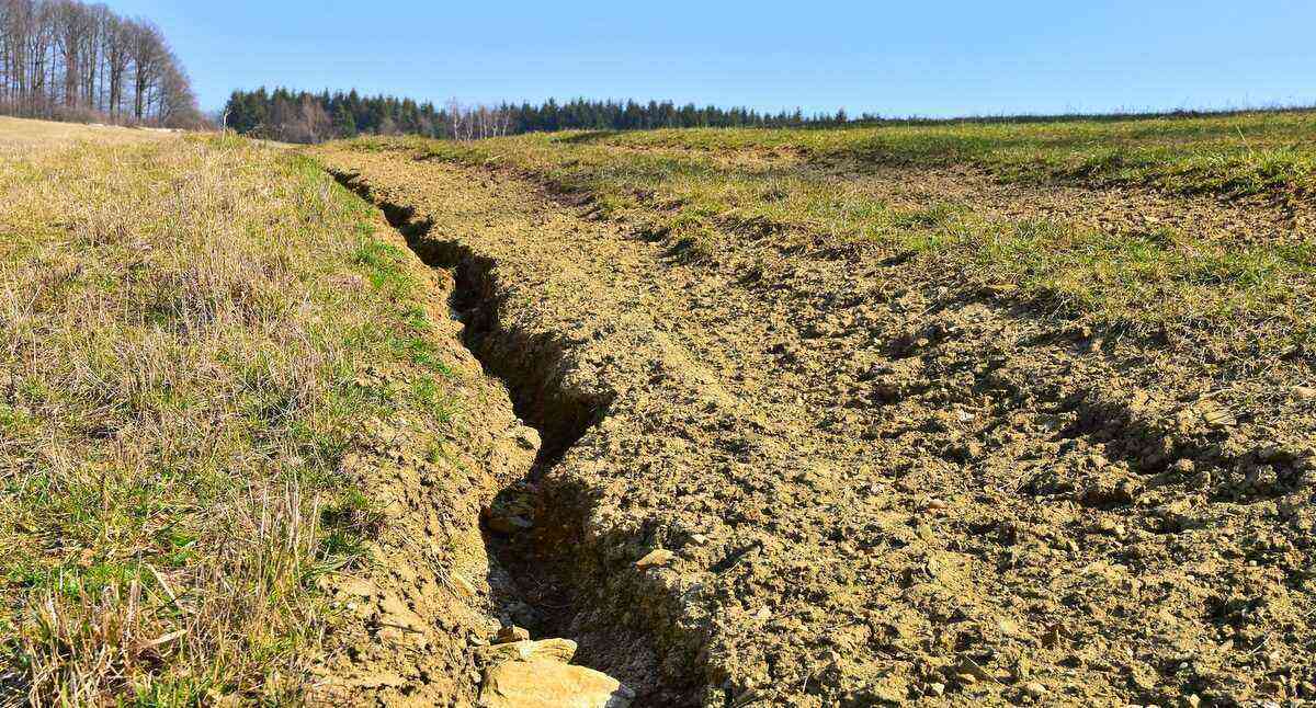
The contour line is used to combat one of the main problems in agriculture: soil erosion.
Soil waterproofing, deforestation, fires, urbanization, road drainage and planting are some of the factors responsible for this process.
After all, preserving the soil, with good techniques that avoid erosion, is the solution to avoid problems such as landslides, silting of rivers, loss of species of fauna and flora, reduction of biodiversity and of the planting area, among others.
On the other hand, less aggressive agricultural techniques, such as no-tillage and contour planting, preserve the vegetation cover of the soil.
According to Empraba researcher Lauro Nogueira, the intensification of the use of heavy machinery, such as the harrow (harrow or holme harrow) and the indiscriminate use of agricultural inputs (herbicides and insecticides) have led to serious problems in the soil.
He reports the most common: loss of the surface layer of the soil through erosion, reduction of the productive capacity and of the soil’s water retention capacity, silting and contamination of water sources as well as environmental degradation (soil, flora and fauna).
level curve
Thus, the contour technique, also known as terracing, is one of the techniques used to conserve soil in crops.
Here, sloped areas are cut transversely by machines such as bulldozers and wheel loaders, creating flat areas known as terraces.
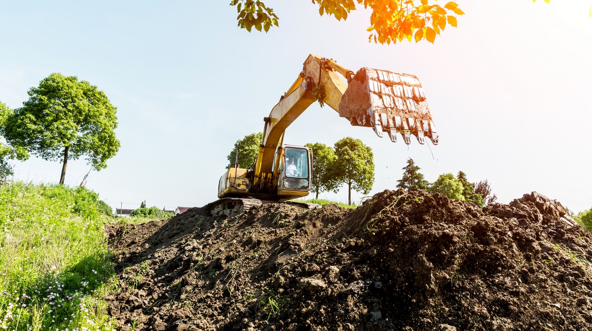
The contour can be opened using equipment such as wheel loaders, creating areas known as terraces.
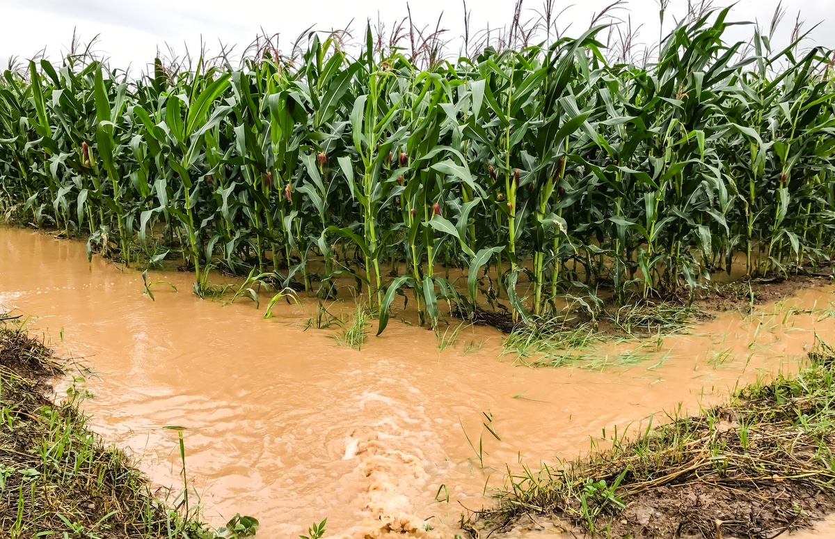
When the rain falls and starts to run down the slopes, the water ends up being retained in these plateaus. In this way, the flow velocity is reduced, reducing the effect of erosion in the areas where the techniques were applied.
In addition, the terrace created from the contour creates the necessary conditions for the accumulation of water, which gives more time for the soil to absorb a greater amount of this liquid.
Therefore, terracing is also an important technique for the maintenance of the local water table.
In order to ensure greater efficiency in this category of agricultural technique, the contour line must be used with other forms of soil management, such as fertilization, liming, crop rotation and covering the soil with straw.
Level curve features
The contour system does not follow a pattern that can be applied equally to all properties.
For the elaboration and execution of this technique, it is necessary to consider information such as the characteristics of the rain in that region (number of times it rains per year), how long (on average) it rains, as well as the capacity of the soil to absorb water that is falling.
The contour curve avoids situations such as waterlogged soils, with floods, harming agricultural production.
It is also necessary to keep in mind issues, such as the type of product being cultivated in that area, the form of planting that will be carried out (intensive, minimal or direct) as well as the management practices applied by the owner.
The terrace is made up of two parts: the collector channel, the area from which the earth is removed for the construction of the terrace and the ridge (flat area), constructed from the soil taken from the collector channel.
Level curve types
The contour curve can be classified in different ways, according to the main function performed. Therefore, if we think about the objectives of the level curve, it can be:
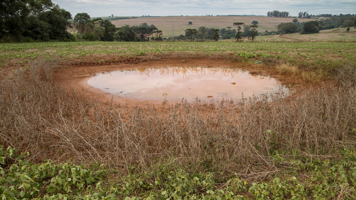
1- Level, retention or infiltration
This type of contour is constructed transversally to the slope and following the topographical characteristics of the slope. Its differential is in the edges of the curve that are closed.
Its function is to capture rainwater and retain it so that it is later absorbed by the soil.
This type of contour line is widely used in soils with high permeability indices, in regions with low rainfall and in areas whose slope does not exceed 12%.
2- unevenness
This contour line is built in such a way that its terrace has a gentle slope, which can be constant or variable depending on the relief. Also, it has one or both edges open.
With the construction of a contour, rainwater is retained for a certain time, preventing runoff to planting areas.
Therefore, its objective is not to dam the rainwater, to facilitate its infiltration into the soil, but to direct the runoff to its edges.
From the edges of the contour, water can be routed to a drainage system, usually a vegetation-covered grotto or a sewer channel. This prevents water from causing erosion and damaging the soil.
Constructing a contour line
Contours can be constructed using two techniques. Are they:
1- Nichol’s
In this model the earth is moved from top to bottom through a small strip of terrain. Therefore, it is indicated for areas whose slopes do not exceed 18%.
The transversal cut has a triangular shape and can be carried out with the aid of a reversible plow and a wheel loader.
The terrace coming from this cut does not present the necessary conditions to be used for cultivation.
2- Mangum or ridge
In fact, in the use of this technique of construction of contour lines, the earth is moved both from top to bottom and from bottom to top. Thus, it is ideal for terrains with slopes of less than 12%.
It can be done with a reversible or fixed plow, with the aid of a median blade.
The result is a wider, shallower channel with greater storage capacity than the previous model, with the cuts having the shape of a parabolic.
How to make a contour
To make a contour correctly it is necessary to calculate the exact distance between the terraces, both vertically and horizontally.
These measurements will indicate which areas of the relief must be cut so that the contour can perform its function.
The vertical spacing between curves can be calculated using several different formulas. One of the most used is the one elaborated by Bertoni:
- EV: vertical spacing between terraces, measured in meters.
- D: terrain slope level, in percentage.
- erosion index: It varies according to soil types and is tabulated to facilitate calculations.
- U: factor referring to land use and is also tabulated.
- M: factor linked to soil preparation and management of crop residues according to a specific table.

With the support of a professional in the area of topography, the farmer is able to build an ideal contour for his property.
With the result of the vertical spacing between the contours, it is possible to calculate the horizontal spacing between the cuts. To do this, just use the following mathematical formula.
On what:
- EV: vertical spacing in meters.
- EH: horizontal spacing in meters.
- D: percentage of slope.
To help with the calculations, the ideal is to hire the services of a topography company, access the MF Rural and find one near you!
In order to guide rural producers, Embrapa Tabuleiros Costeiros, a unit in Aracaju, launched a graphic animation that shows step by step how to correctly perform a level curve.
Didactically produced by Embrapa’s Organizational Communication Center, the graphic animation shows the five steps necessary for the rural producer himself. Look:
Source: Embrapa.
Check out 5 steps to build the contour line
With the ConservaSolo project, under the responsibility of researcher Lauro Nogueira, it is possible to encourage good agricultural practices through soil conservation. Check out 5 techniques:
1 – Know if the soil is sandy or clayey
In order to start terracing, you need to take five soil samples in the 0-20 cm layer. They should be placed in a bucket and mixed.
Then, separate a handful of earth and wet it with water, without soaking. Mix and knead the soil, forming a cord approximately one centimeter thick.
Then, bend the cord until it forms a horseshoe. According to Embrapa, if the cord breaks, the soil on your property is sandy. If it doesn’t break, the soil is clayey.
2 – Learn to calculate the slope
To start, place a wooden pike in the highest part of the terrain. After 30 meters, plant the second picket. Then take the hose and fill it with water.
Place one end of the hose on the top picket and the other end on the bottom picket. Then measure the distance between the ends of the water in the hose and the surface of the ground in the two pickets.
Calculating the slope: Subtract the value found on the paddock below by the value found on the top. Take the subtraction value and multiply it by 100 and then divide by 30, which is the distance between the two paddocks. The result found will be the slope of the terrain.
3 – Distance between the terraces
Then place a picket at each indicated distance. For example, if the slope is 4%, the spacing between each wooden picket will be 21,10 meters in sandy soil and 14,10 meters in clayey soil.
4 – Place the pickets every 30 meters
Take the hose already with water and the pickets. Then, place the end of the hose in the first picket, which is already placed on the ground, and look for the same level of the hose to plant another picket at 30 meters. Repeat the procedure until the end of the terrain.
According to Embrapa, as pickets were placed every 30 meters, the ideal is to smooth the curve, placing pickets every 15 meters without the need to use a hose.
5 – Build the terrace with tractor and plow
First, adjust the plow so that the third disc cuts deeper into the soil, at least 30 centimeters.
The first disc should cut more superficially, at least 10 centimeters. After adjustment, the plow must be inclined.
Next, start plowing the land by moving the soil from the top to the bottom until the end of the contour curve. Go back cutting the earth, throwing it from bottom to top.
Thus, the ideal is to repeat the process until the base of the terrace is 1,5 meters to 2 meters wide and the height reaches more than 70 centimeters.
According to Embrapa’s instructions, 6 to 10 passes of the plow will be necessary. When the procedure is carried out on all curves, the terrace is ready.
No video below, see how to mark a contour line:
Source: Rio Grande Rural.
Therefore, the contour line is an important technique to help rural producers ensure the success of their farming.
By the way, if your concern is with soggy soils, visit our post that shows the importance of soil drainage in agriculture. Check out!


