The georeferencing of rural properties has brought a very positive change to the countryside, especially in relation to the identification of properties. Through this solution, it is possible to use maps or images to recognize the geographic coordinates of a property.
Fortunately, with technology, this process is quite simple. It allows you to recognize the boundaries of a property more accurately and without as much effort. But, is it worth it? Keep reading the post and find out if you should georeference the rural property.
And if you like the post, check out other articles from MF Magazine to stay on top of all the news in this market.
Why should you georeference?
First of all, Incra determined that any rural property, public or private, must be georeferenced. The idea is that there is a standard to determine the characteristics of properties, and this procedure should be adopted by any owner.
Decree 4499/2002 made this process official, stipulating a deadline for properties to be georeferenced. Otherwise, the owner may be prevented from updating the registration of the property at the registry office.

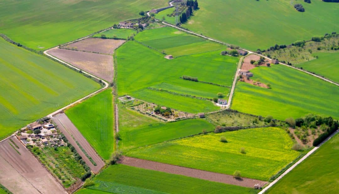
It is possible to georeference a rural property using drones.
Are there any advantages in georeferencing the rural property?
However, it is not just because of Incra’s determination that this process is worth doing. There are other advantages for the owner. Let’s see some of the main ones:
Property valuation on the market
Imagine that a buyer is interested in a property. If the same is already georeferenced, it is less of a concern that he needs to have during the process. Otherwise, he has to bear the costs and labor to do so. That is, the value of the property is positively impacted.
Ease of getting financing
In the same way that prospective buyers like to have more security, the same applies to banks. At some point, you may need to take out a bank loan. Some institutions adopt georeferencing as a condition for it.
Taking out rural insurance
Following the flow of information and security control, contracting rural insurance is also facilitated by those who have information through the georeferencing of the property. Some insurers even bring this term as one of the possible conditions for accepting insurance proposals.
Less headache and more information for the owner
Finally, from the owner’s point of view, georeferencing has great advantages. First, there is more security. Upon receiving the certification of the property that has already gone through this process, there is a guarantee that it is not overlapping another property or a reserved area.
With georeferencing, the owner has accurate information about the delimitation of his farm
In addition, the accuracy of property mapping also benefits the producer. Through it, it is possible to trace the field more precisely, which means that the control over the crop is better.
As current agricultural production is heavily based on technology and information, the more of it, the better. Thus, it is possible to apply some more modern techniques and procedures.
Did you know that it is possible to Georeference a rural property using drones? Check out the video below to see how it works:
Source: Horus Aircraft
Conclusion
As it became clear, georeferencing the rural property is very interesting. Not only is it a matter of meeting requirements, but it also brings benefits to the producer.
Does your property still not have georeferencing? Access the MF Rural and choose one of the registered companies to carry out this important procedure.
See also list of more than 3 thousand farms available for business.


